
Builders & developers
Construction Progress Documentation & Site Mapping
Flight-planned aerial documentation for builders, developers and site teams — repeatable, measurable, and easy to share with lenders, partners and buyers.
Progress documentation over time
Flights are planned so each visit repeats the same altitude, angles and coverage. The result is a set of images that line up cleanly month over month, making change genuinely readable instead of a pile of loosely related photographs.
- Repeatable flight plans across visits
- Stitched high-resolution top-down site maps
- Oblique aerials for elevation and context
- Ground-level coverage of finished areas and amenities
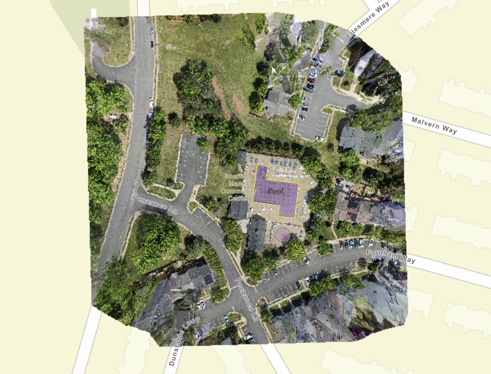
Orthomosaic site maps
Individual aerial frames are stitched into a single high-resolution top-down map of the full site. Roads, pads, phases and amenity areas can be labeled, and the output is easy to drop into a presentation, a lender update or a marketing page.
Marketing the finished community
The same aerial program that documents construction also produces the marketing library — community amenity photography, model home coverage, and the elevated establishing shots a sales office needs on day one.
Frequently asked questions
- Who is this service for?
- Builders, developers, property managers and site teams who need repeatable documentation of a project as it progresses, plus marketing imagery of the finished community.
- Is this work flown legally?
- Yes. All aerial work is flown by a commercially insured FAA Part 107 certified remote pilot, with airspace authorization requested in advance where required.
- How is progress work priced?
- Progress documentation and mapping are quoted per site based on acreage, visit frequency and deliverables. Send the site details and you will get a straight quote. Request a project quote
Related services
Aerial Drone Photography
Elevated perspective flown by an FAA Part 107 certified, commercially insured remote pilot — showing lot lines, setting, roofline, water access and everything a ground camera cannot reach.
Real Estate Photography
Interior and exterior listing photography for agents, builders, property managers and owners throughout Northern Virginia and the Lake Anna corridor — bright, true-to-color, and delivered the next business day.
Real Estate Videography
Cinematic walkthroughs, continuous FPV fly-throughs and vertical social cuts — property films that market the listing and the agent behind it.
Next-business-day photo delivery is standard, with same-day delivery often available. All aerial services are provided by an FAA Part 107 certified, commercially insured drone operator. View all services · Compare package pricing · Request a custom quote
Next Step
Ready to book construction progress documentation?
Send the address and a few details — you'll get a straight recommendation and a quote, not a sales pitch.