
Aerial drone photography
Aerial Drone Photography in Northern Virginia & Lake Anna
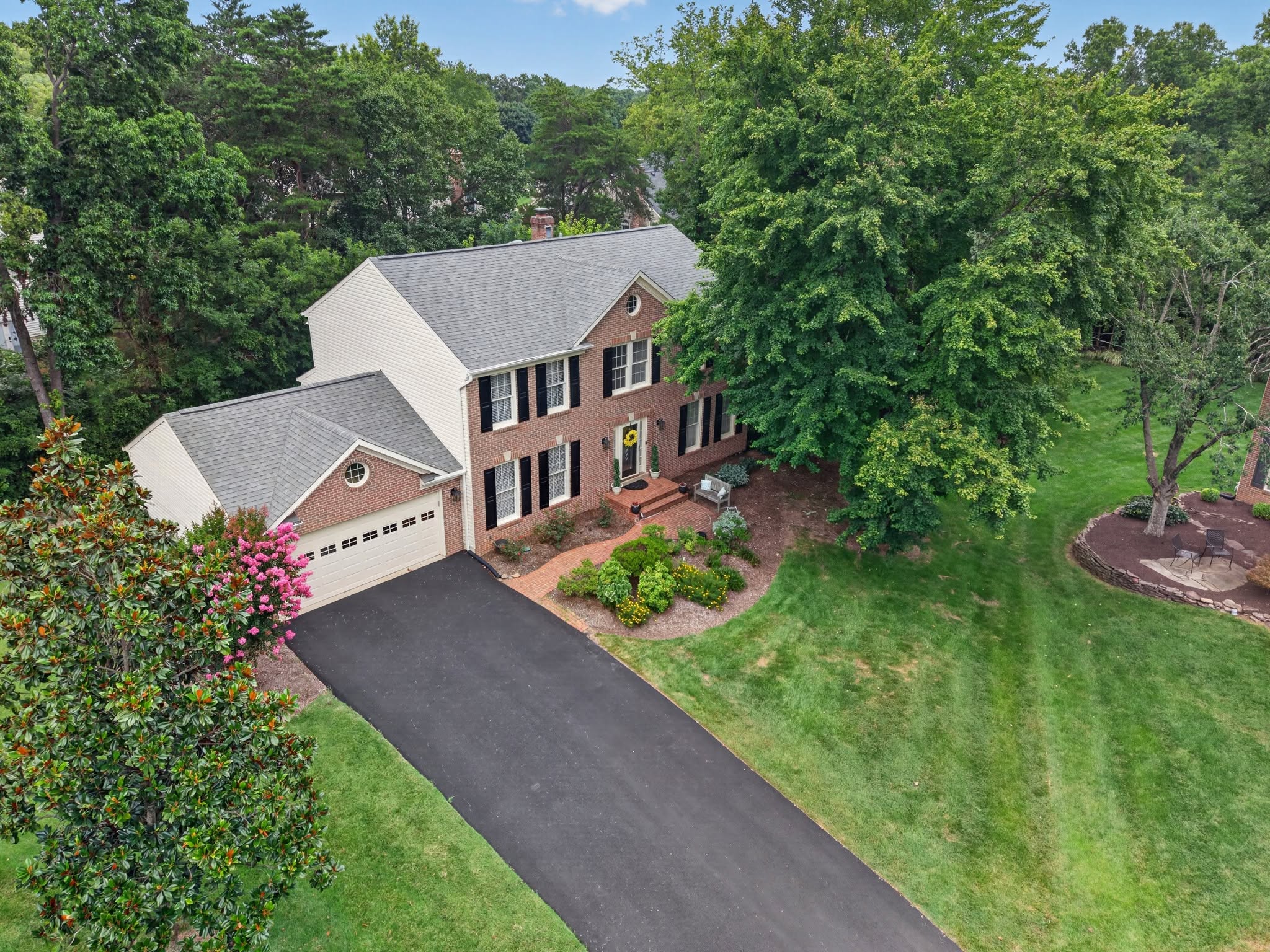
Elevated perspective flown by an FAA Part 107 certified, commercially insured remote pilot — showing lot lines, setting, roofline, water access and everything a ground camera cannot reach.
Why aerial changes how a listing reads
Ground photography answers what the house looks like. Aerial answers where it sits — the size and shape of the lot, the tree line, the distance to the water, the community pool two streets over. On acreage and waterfront property that context often carries more weight with buyers than any interior frame.
- Elevated exterior and roofline coverage
- Lot context, setting and proximity to amenities
- Shoreline, dock and water-access detail on waterfront listings
- 360-degree aerial panoramas for full-sphere neighborhood context
- Property line overlays drawn from supplied or public parcel data
Credentials, insurance and airspace
Flights are conducted by a commercially insured FAA Part 107 certified remote pilot, certified since 2019 and flying since 2013. Much of Northern Virginia sits under controlled airspace, so authorization is requested in advance where it is required and available.
When aerial cannot be flown
Drone operations remain subject to weather, airspace restrictions, safety conditions and FAA authorization. When aerial coverage cannot be flown safely or legally you will be told before the shoot and the scope adjusted — never quietly dropped from the delivery.
Frequently asked questions
- Is drone photography included in a package?
- Aerial coverage is included in the Essentials and Signature packages, but it is flown only when weather, safety and FAA airspace rules allow.
- Are you licensed and insured to fly commercially?
- Yes. All aerial work is flown by a commercially insured FAA Part 107 certified remote pilot.
- Can you fly in restricted airspace near D.C.?
- Where a location requires FAA airspace authorization, it is requested in advance wherever authorization is available. Some locations cannot be flown legally, and you will know before the shoot.
Related services
Real Estate Photography
Interior and exterior listing photography for agents, builders, property managers and owners throughout Northern Virginia and the Lake Anna corridor — bright, true-to-color, and delivered the next business day.
Real Estate Videography
Cinematic walkthroughs, continuous FPV fly-throughs and vertical social cuts — property films that market the listing and the agent behind it.
Construction Progress Documentation
Flight-planned aerial documentation for builders, developers and site teams — repeatable, measurable, and easy to share with lenders, partners and buyers.
Next-business-day photo delivery is standard, with same-day delivery often available. All aerial services are provided by an FAA Part 107 certified, commercially insured drone operator. View all services · Compare package pricing · Request a custom quote
Next Step
Ready to book aerial drone photography?
Send the address and a few details — you'll get a straight recommendation and a quote, not a sales pitch.