
Culpeper, Virginia
Real Estate Photography in Culpeper, VA
Culpeper listings run from in-town residential to working farms and raw land, and the media has to shift with them — sometimes on the same day.
- Culpeper
- Culpeper County
What listings here need
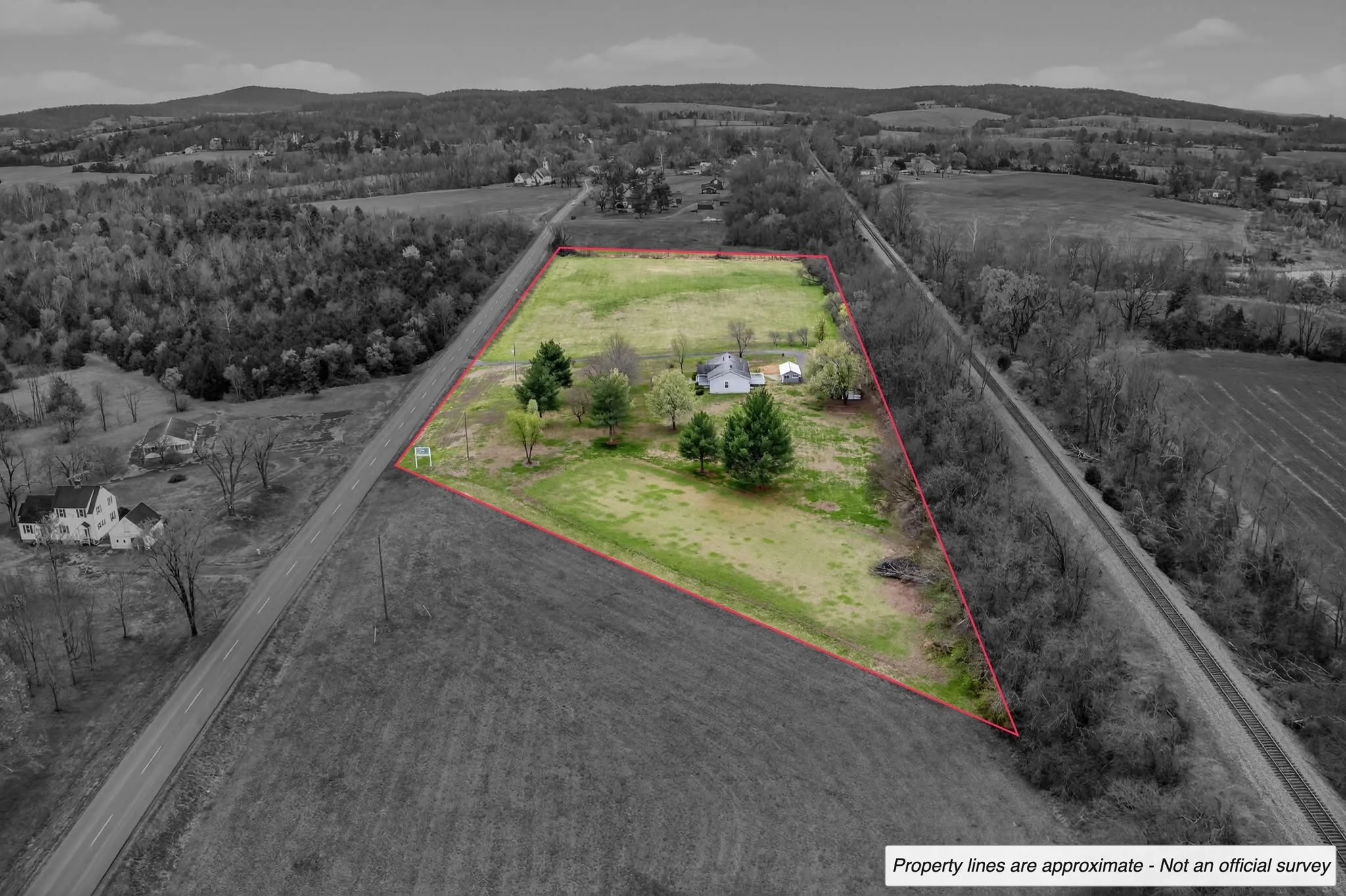
In town, it is straightforward residential work done well: clean interiors, honest exteriors, a floor plan and enough frames to cover the whole house. Outside town the assignment changes. Land, farms and acreage are bought on questions that ground-level photos cannot answer — where the parcel starts and stops, how the fields and treelines lie, what condition the outbuildings are in, how the road frontage works.
- Unlimited edited interiors and exteriors on residential listings
- Aerial coverage for acreage, fields, treelines and road frontage
- Property-line overlays where parcel data is supplied
- Orthomosaic mapping for larger tracts
- Outbuilding, barn and equipment-structure documentation
Land and farm marketing
A land listing with a single roadside photo asks buyers to imagine everything. An aerial set with boundary overlays and, where useful, an orthomosaic map does the opposite: it hands buyers the shape and scale of the parcel directly. That same coverage supports agents pitching land listings and owners marketing farms with a mix of residential and agricultural structures.
Booking, travel and turnaround
Culpeper is regularly on the schedule, and multi-property days are easy to arrange with a little notice. Photos are delivered the next business day as standard with same-day often available. Travel is quoted honestly and stated before booking: no fee inside the 60-mile radius from Bristow, $2 per mile beyond it. David handles every project personally and is FAA Part 107 certified and commercially insured.
Services in Culpeper
Aerial Drone Photography
Elevated perspective flown by an FAA Part 107 certified, commercially insured remote pilot — showing lot lines, setting, roofline, water access and everything a ground camera cannot reach.
Real Estate Photography
Interior and exterior listing photography for agents, builders, property managers and owners throughout Northern Virginia and the Lake Anna corridor — bright, true-to-color, and delivered the next business day.
3D Tours & Floor Plans
Interactive walkthroughs and measured layouts that answer the two questions photography cannot: how the rooms connect, and how big they actually are.
Real Estate Videography
Cinematic walkthroughs, continuous FPV fly-throughs and vertical social cuts — property films that market the listing and the agent behind it.
$2 per mile outside a 60-mile radius from Bristow, Virginia. Next-business-day photo delivery is standard, with same-day delivery often available. See every area we cover
Culpeper questions
- Do you photograph land and farm listings in Culpeper County?
- Yes. Land, farms and acreage are covered with ground and aerial imagery, including outbuildings, fencing and road frontage.
- Can you add property lines to the aerial photos?
- Yes, where parcel data is supplied. Orthomosaic mapping is also available for larger tracts. Aerial & mapping
- Is there a travel fee to Culpeper?
- Addresses inside the 60-mile radius from Bristow have no travel fee. Beyond that radius the fee is $2 per mile and it is stated in the quote before booking.
- Can you shoot more than one property in a day here?
- Yes. Multi-property days are regularly scheduled and are usually the most efficient way to cover several listings in the same area.
Nearby coverage
Shooting elsewhere in the region? These pages cover the markets closest to Culpeper.
Region
Real Estate Photography in Northern Virginia
Nearby
Real Estate Photography in Warrenton, VA
Nearby
Real Estate Photography in Mineral & Bumpass, VA
Nearby
Real Estate Photography at Lake Anna, Virginia
Compare package pricingBrowse recent workExplore aerial photographyExplore cinematic videoExplore 3D tours and floor plansAll servicesRequest a custom quote
Next Step
Booking a shoot in Culpeper?
Send the address and a few details — you'll get a straight recommendation and a quote, not a sales pitch.